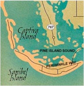
If you look at Sanibel and Captiva Islands, you’ll see that together they are in the shape of a banana (or a shrimp!) lying east to west and act as a scoop for gathering seashells on their beaches.
All along the Southwest Florida coast shells are pushed to the shores from the Gulf of Mexico and the Caribbean. As you can see from this map, the barrier islands of Sanibel and Captiva stick out just enough to act as a net to catch most of the shells. The undersea of the Gulf of Mexico mildly slopes toward the islands, and the gentle waves keep the rolling shells intact. As geography plays a role in capturing shells for Southwest Florida, so does weather and tidal flow.
Browse through iLoveShelling.com and pages of tide tables, local weather, moon phase and FAQS and Shelling Tips to make your shelling adventure as bountiful as possible. While you are shelling, don’t forget to to look up every once in a while. Stop. Take a 360-degree view. You’ll be a sheller for life.

